What is drone mapping? Everything you need to know about mapping with drones
Drone mapping involves surveying an area and collecting data with the use of drones. Also known as drone surveying, in infrastructure and construction projects it allows organizations to achieve highly detailed data collection with greater efficiency, accuracy, and safety than traditional methods of mapping. Here’s everything you need to know.
How does drone mapping work?
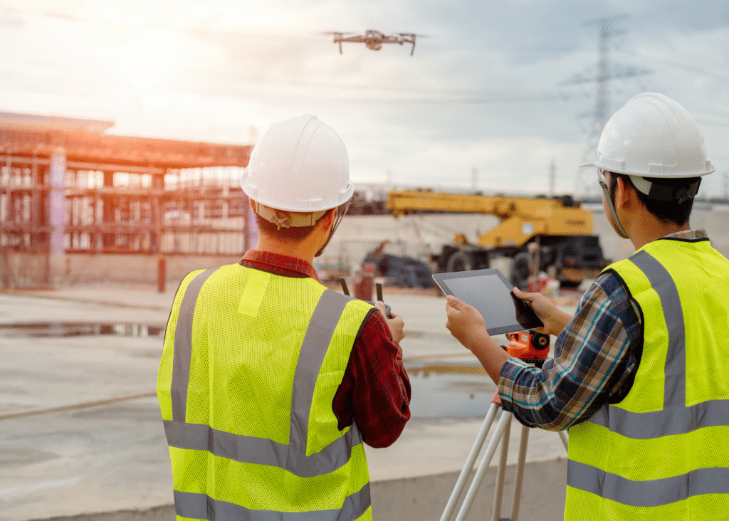
Unlike traditional methods of mapping and surveying, drone mappingDrone mapping is the process of creating maps and 3D models of geographic areas using images and data captured by drones… More involves aerial mappingThe term aerial mapping refers to a technique that captures photographs and measurements from above using unmanned drone… More technology. The drones take pictures from the air, and then these are stitched together using advanced software to create an accurate representation of any given area.
This is known as photogrammetryPhotogrammetry is the science of obtaining accurate measurements and three-dimensional information from photographs. It … More, collecting and combining overlapping images from various angles to gain a complete and accurate representation of any topography. links each area of the project with a physical global coordinate, so that teams can digitally drill down in greater detail and accuracy than they could ever achieve with the human eye.
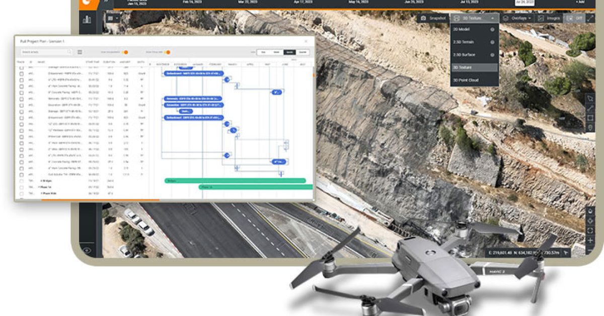
Every time you send a drone out, it will create a digital twinA digital twin is a virtual replica or simulation of a physical object, process, or system. It is a digital model that r… More of your construction project, allowing you to compare information against a baseline and keep track of progress. Drone data survey processing allows for data to be processed on the cloud, or for images to be processed on local computers and then uploaded to the cloud at a later point. By uploading the information to a single centralized platform managers can achieve deeper analysis and business intelligence.
Drone mappingDrone mapping is the process of creating maps and 3D models of geographic areas using images and data captured by drones… More often utilizes LiDARLidar (Light Detection and Ranging) is a remote sensing technology that uses laser light to measure distances and create… More systems to gauge distance using laser scanningLaser scanning is a technology used to capture and create highly-detailed and accurate digital representations of physic… More. With LiDARLidar (Light Detection and Ranging) is a remote sensing technology that uses laser light to measure distances and create… More technology, pulses of light are sent out, and the time it takes for the reflection to return is measured. This allows the drone to accurately measure the distance between the LiDARLidar (Light Detection and Ranging) is a remote sensing technology that uses laser light to measure distances and create… More sensor and the elevation of the ground, perfect for building an accurate digital model, representing the real-world terrain of a specific area.
Benefits of drone mapping in construction
Specifically for heavy civil infrastructure projects and transportation, drone mappingDrone mapping is the process of creating maps and 3D models of geographic areas using images and data captured by drones… More, and drone data processing is a game changer for surveying. Benefits include:
- Accurate and detailed data: Drones can collect high-resolution aerial data that provides much greater detail and insight than manual surveying can achieve. With a software platform that includes data analytics, this can support better planning and business analysis.
- Automation: Manual data collection slows down decision-making, and creates bottlenecks while data is collated, checked, and uploaded to the system. Drone data can be processed and analyzed in real-time.
- A more comprehensive view: There are many areas that human mappers and surveyors simply can’t reach, or that are difficult and dangerous to survey. Drone mappingDrone mapping is the process of creating maps and 3D models of geographic areas using images and data captured by drones… More allows for accurate imagery of large, inaccessible or dangerous topography.
- More cost-effective mapping: Drones reduce the need for large teams of surveyors to make multiple trips to design construction sites and keep up with progress and materials. Drone mappingDrone mapping is the process of creating maps and 3D models of geographic areas using images and data captured by drones… More also limits the reliance on expensive equipment.
- Improved safety: In dangerous or hazardous environments, drone mappingDrone mapping is the process of creating maps and 3D models of geographic areas using images and data captured by drones… More can replace human mappers and eliminate the risk of causing personal injury or harm, without limiting a complete view of a terrain.
What is drone mapping used for?
It’s also important to understand how drone mappingDrone mapping is the process of creating maps and 3D models of geographic areas using images and data captured by drones… More is used in construction. Our customers use our digital construction platformDigital construction platforms are used to streamline and optimize construction processes using digital technology. They… More for many use cases from design through to dispute resolution, but three of the main applications are:
Earthworks
EarthworksEarthworks are an essential part of modern infrastructure and are used in a variety of industries including construction… More and stockpile measurementsStockpile measurements in the realm of construction or earthworks pertain to the systematic process of quantifying and a… More can be extremely challenging and expensive. Drone mappingDrone mapping is the process of creating maps and 3D models of geographic areas using images and data captured by drones… More allows project managers to increase the frequency of their reporting as well as its accuracy.
This gives a clear understanding of topsoil, dirt, gravel, construction debris, and any other materials whether they are being excavated, filled, or stockpiled. Instead of relying on outdated information or guesswork, drone mappingDrone mapping is the process of creating maps and 3D models of geographic areas using images and data captured by drones… More provides real-time accurate data on cut/fill measurements, which can then be used for predictive decision-making ahead of time, and for resource planning, cost control, and reporting and compliance.
Planning and bidding
At the plan and bid stage, the more information the better. Aerial mappingThe term aerial mapping refers to a technique that captures photographs and measurements from above using unmanned drone… More technology provides a complete view that can then be used as a pre-construction baseline, allowing teams to consider questions such as what are involved, what their plans are for excess materials, or how to set a process in place for minimizing disruption.
Construction managers can also compare their own accurate images with pre-existing design plans, identifying any deviations at the earliest stages to avoid rework or too low an initial bid. This visibility is critical to obtain ahead of that bid, as working with outdated survey information may mean you pitch too low or too high. Bonus? It shows owners that you’re ready to hit the ground running with transparency and control.
Progress tracking and monitoring
Drone mappingDrone mapping is the process of creating maps and 3D models of geographic areas using images and data captured by drones… More allows project managers to achieve ongoing documentation over their construction sites, ensuring accurate billing and full visibility across the lifecycle of any project. Instead of manually visiting construction projects on-site for progress checks, using drone mappingDrone mapping is the process of creating maps and 3D models of geographic areas using images and data captured by drones… More can allow managers to complete the same tasks in 50% of the time.
Digital twins then allow for better ongoing management, comparing images on different dates, performing quality control with subcontractors, and using data and analytics to collaborate smarter and share updates and status reports.
Using drone mapping software such as DatuBIM
The right drone mapping software can change the way you approach every step of the construction lifecycle when working on transportation or heavy civil and infrastructure projects. With a cloud-based 4D infrastructure constructionInfrastructure construction refers to the process of designing, planning, and building physical structures and facilitie… Moreconstruction data analyticsConstruction data analytics involves using data to gain insights and make informed decisions related to construction pro… More platform like DatuBIM, project owners and contractors can reduce risk and uncertainty, limit costly rework, and enable better collaboration, monitoring, and control from design through to inspection.
Instead of sending mappers and surveyors who work with a manual approach, drone mappingDrone mapping is the process of creating maps and 3D models of geographic areas using images and data captured by drones… More offers a cost-effective and efficient way to gather more information about any site, to analyze it from a single centralized cloud-based platform for any stakeholder to view, and to integrate and collaborate alongside other software solutions. This adds benefits from the planning and bidding stages, through to monitoring and collaboration, and all the way to accurate billing and streamlined dispute resolution.
Let’s schedule a time to discuss how a photogrammetryPhotogrammetry is the science of obtaining accurate measurements and three-dimensional information from photographs. It … More and drone mapping softwareDrone mapping software is a type of software that is used to create accurate maps and 3D models from data collected by d… More solution with data analytics could be the missing piece for your next construction project.


