Manage and monitor site operations efficiently with photogrammetry and drone mapping software
Connect field to office and closely manage and monitor your infrastructure construction projects
When construction sites are located far from your office, spread across multiple locations, or when manpower is limited, effectively monitoring and managing infrastructure constructionInfrastructure construction refers to the process of designing, planning, and building physical structures and facilitie… More projects can be extremely challenging.
DatuBIM offers a solution to this challenge. By leveraging digital aerial surveys, accurate data analytics, actionable insights, and AI predictions, DatuBIM enables you to replace on-site foot topos. With this technology, you can remotely monitor project progress, ensure quality, and proactively identify and resolve potential issues before they escalate and require costly rework.
Powering decision-making for complex infrastructure and civil construction across the project lifecycle


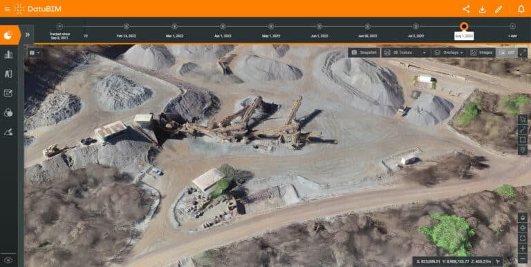
Example
Background
- Geographically dispersed environments and increasing shortage in professional personnel make tools for remote management and monitoring crucial.
Solution
- For a large mining project in Brazil (200 acres and 150-meter drop), the project owner located in Australia needed a way to monitor the condition of its asset and the progress of work remotely and in near real-time
- With DatuBIM, the project owner can do this from anywhere and at anytime by replicating the mine in a digital environment.
Results
- Collaboration was greatly improved between the field and the office across different countries
- Volume of materials extracted from the mine could be accurately calculated
- Resulted in a 12% increase in the mine's productivity and a 50% reduction in collapsed walls
Keep a close eye on your project at every stage of its lifecycle
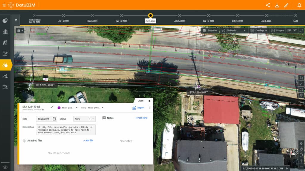
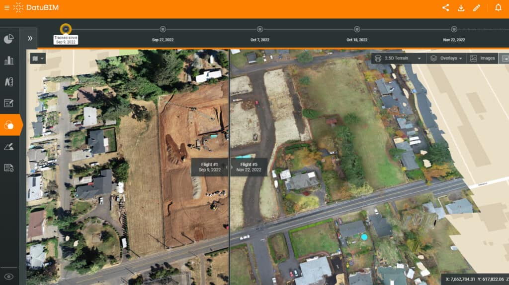
With DatuBIM, you can rely on an “eye in the sky” solution. Utilizing drone images and laser scanningLaser scanning is a technology used to capture and create highly-detailed and accurate digital representations of physic… More data, DatuBIM generates survey-grade models and maps, along with shared data analytics, insights, and forecasts. Additionally, you’ll receive ongoing progress reports and comparisons against the design or previous as-built“As-built” refers to the final and accurate documentation of a completed construction project or engineering design. It … More versions. This enables you to obtain a clear view of your site at any time and from wherever you are.
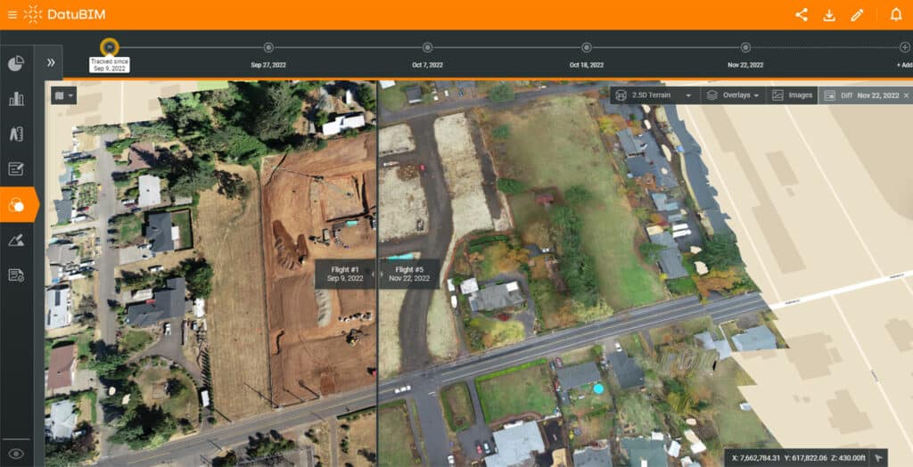
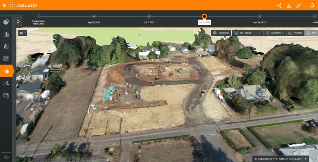
Monitor your progress using accurate as-built digital twins
These digital twins enable you to compare between different project phases, visualize changes and completed work, track construction progress through cross-section analyses, identify deviations from the plan, conduct quality assurance, inspections, and site supervision. Furthermore, once your project is completed, you can closely monitor ongoing operations and maintenance.
Work closely with project collaborators at any time, from anywhere
Seamlessly collaborate with all project stakeholders across multiple sites by sharing information and 3D models, discussing project details, and addressing concerns in real-time – resulting in improved coordination, effective problem-solving, and better decision-making.