Datumate for General Contractors
Revolutionize your infrastructure construction projects with drone and laser scanning technology

Discover the transformative power of drone and laser scanningLaser scanning is a technology used to capture and create highly-detailed and accurate digital representations of physic… More mapping technology. Tailored to the unique needs of general contractors, our platform helps you boost your bid success rates, enhance your project planning and design, and stay on track with visual progress tracking and AI-based predictions. Use advanced 4D capabilities4D capabilities, in the context of construction management tools, refer to the integration of time (the fourth dimension… More to integrate with scheduling tools, enhance project coordination and alignment, cut costs, better utilize your existing resources, and save time. Improve your probability of winning legal claims, cut costs and better utilize your existing resources to gain a competitive edge.
Harness the capabilities of this advanced technology to make informed decisions, streamline operations, and showcase your leadership in the industry.
Let’s unlock the full potential of your projects together.
Powering decision-making for complex infrastructure and civil construction across the project lifecycle


Boost your bid success rates through detailed site analysis and visual project representations
Enhance your competitive advantage by utilizing comprehensive and precise site surveys and showcasing your projects in a visually compelling manner. Leverage thorough site analyses, optimized project designs, and more accurate cost estimates to demonstrate your commitment to quality and meticulous attention to detail. This, in turn, will instill confidence in potential clients, increasing your chances of winning more bids and maximizing profitability.
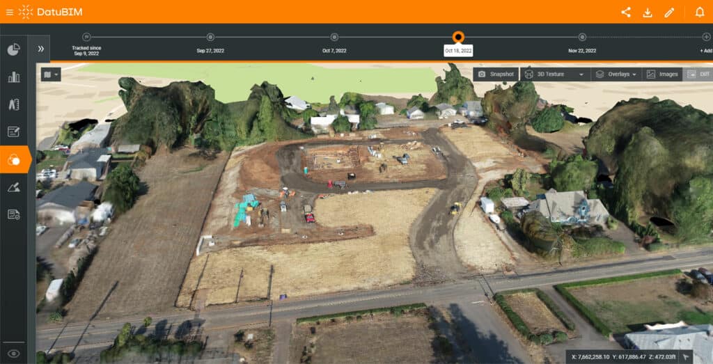
Enhance project planning and design with 4D capabilities and accurate site data
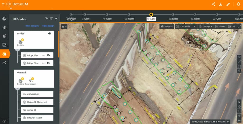
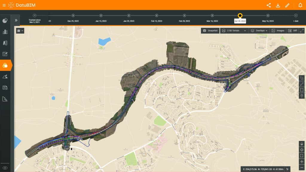
Elevate your project planning and design processes by leveraging accurate site data and 4D capabilities4D capabilities, in the context of construction management tools, refer to the integration of time (the fourth dimension… More to integrate with project scheduling tools. With the ability to create up-to-date 3D models and digital terrain maps using precise information gathered from the site, you gain a comprehensive and visually immersive view of the project area. This invaluable resource can be accessed from any location, allowing you to identify potential challenges, proactively solve problems, optimize resource allocation, adapt project designs and plans as needed, and ensure seamless coordination among all stakeholders. Harness the power of accurate site data to optimize every aspect of your project from inception to completion.
Connect field to office and stay on track with visual progress tracking
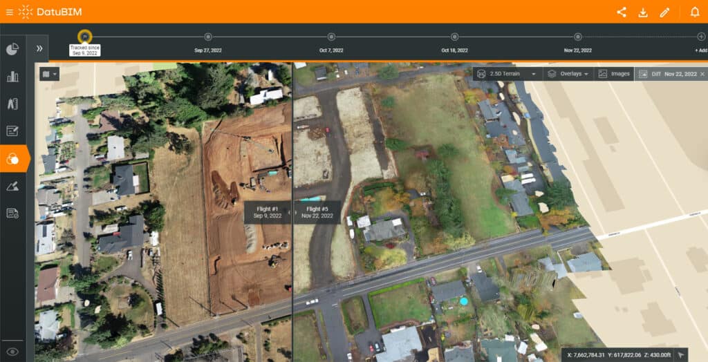
Maintain control and confidence of your projects with visual progress tracking and AI-based predictions. Seamlessly compare site conditions to initial plans and between different dates, closely monitor project milestones, promptly identify any deviations or delays, and ensure your projects stay on track and on schedule. With access to accurate site data, optimize resource management, proactively solve problems, and gain the necessary insights to keep your projects within budget. Experience the transformative power of real-time progress tracking coupled with advanced AI capabilities to drive successful project outcomes.
Improve project coordination and alignment through seamless communication and collaboration
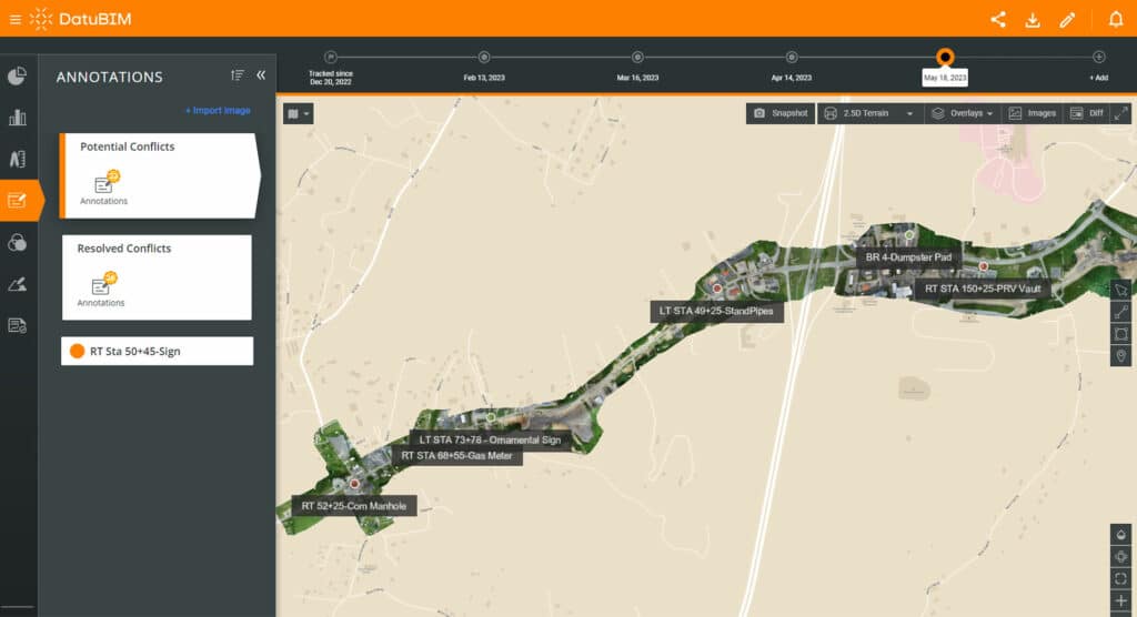
Elevate your project coordination and alignment through improved communication and collaboration. Connect the right people to the right information at all times, regardless of their location. Effortlessly communicate project updates, share aerial images, and engage in discussions about design changes with enhanced clarity and effectiveness. This seamless communication fosters improved collaboration among team members, project owners, subcontractors, and other stakeholders, creating a cohesive and efficient project environment.
Cut costs and save time by reducing the need for manual inspections and doing more with existing resources
Capture large areas of data in a relatively short amount of time. Minimize the need for extensive fieldwork and manual labor traditionally required for data collection to significantly cut costs by reducing the number of personnel required onsite, lowering travel expenses and reallocating resources to other critical tasks. Make decisions faster, respond quickly to changing conditions, identify issues as they arise, and implement corrective measures to improve overall efficiency and reduce downtime.
Gain a competitive edge, elevate customer satisfaction and loyalty, and showcase technological leadership
Gain a competitive edge in your industry and elevate customer satisfaction and loyalty with accurate data-driven insights that enable proactive decision-making and efficient asset management. Showcase your technological leadership by embracing innovative solutions that set you apart from competitors, positioning you as a forward-thinking and innovative market leader.