Use drone mapping and photogrammetry to replicate your site and future-proof your projects
In the fast-paced world of infrastructure constructionInfrastructure construction refers to the process of designing, planning, and building physical structures and facilitie… More, time is of the essence, and ensuring accurate design evaluation and validation is crucial for successful project outcomes. When you factor in the unique elements presented by each construction site, such as geographical location, environmental regulations, budgetary constraints, and more, the challenges multiply tenfold.
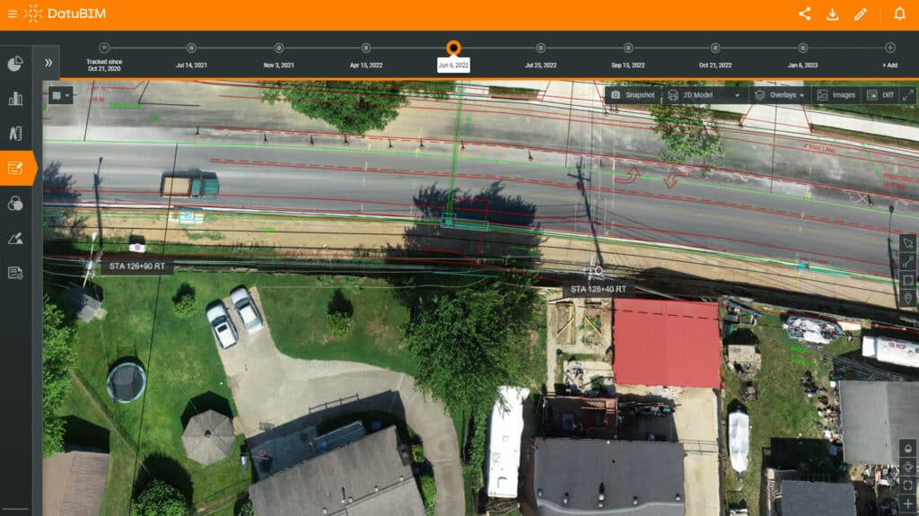
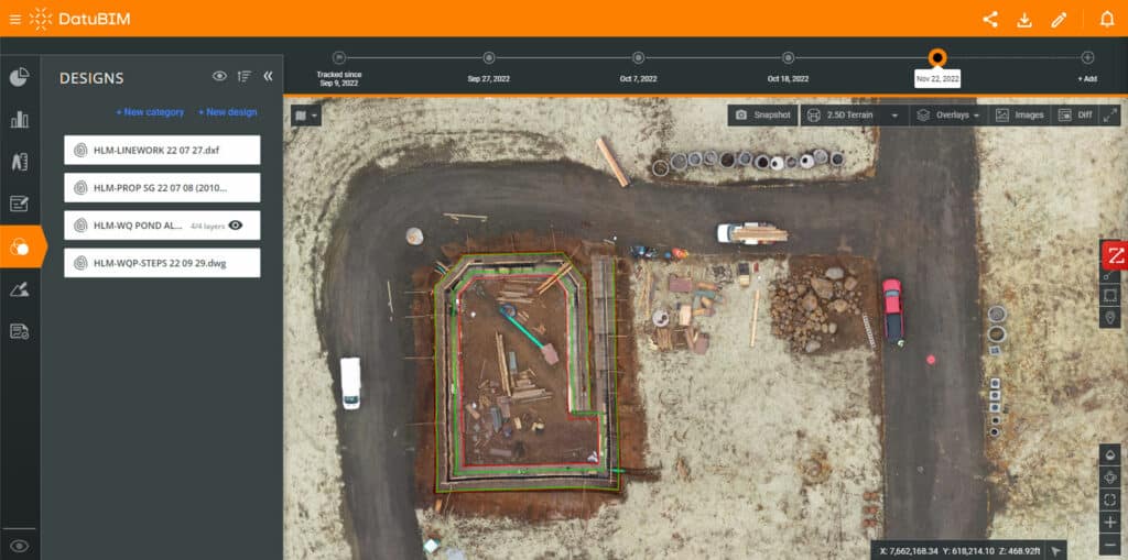
With DatuBIM, you can overcome these obstacles and future-proof your projects. Our platform allows you to replicate your site during the pre-construction phase, enabling you to compare site conditions to designs and gain a clear understanding of site-specific constraints and opportunities at the earliest stages of the project. By leveraging DatuBIM, you can proactively address challenges, make informed decisions, and set your project on a path to success from day one.
Powering decision-making for complex infrastructure and civil construction across the project lifecycle


Example
Background
- The design and planning of underground power transmission cables offers multiple advantages but also comes with some challenges
- These include the need to coordinate with multiple stakeholders to prevent any conflicts and objections prior to construction
- A UK-based contractor used DatuBIM to overcome these challenges during the design phase of a new 60-km long underground cable system in a large green energy power transmission project
Solution
- During the design phase of the project, the general contractor used DatuBIM to overlay and compare design files from different stakeholders with the actual conditions
- This enabled the general contractor to identify potential issues and deviations, share them with all stakeholders and update the design accordingly before construction began
Results
- The digital approach to data capture, analysis, visualization and reporting enabled the team to more easily define construction boundary limits for the planning application during the design phase
- It also enabled more collaboration by giving multiple users from both the contractor and the owner access to a single source of truth from different locations and time zones

Streamline and optimize design and planning
Identify potential design flaws or inefficiencies early on to prevent modifications during the construction phase and costly rework. Save both time and money and maximize overall project profitability for all stakeholders involved.
Collaborate on design and improve transparency
Create an accurate replica of site conditions and a single source of truth for designers, engineers, and other stakeholders. With enhanced communication and a shared platform for design evaluation and validation, team members can work together more effectively, leading to better coordination, fewer misunderstandings, and improved project outcomes.
Enhance quality and accuracy and minimize risk
Ensure higher quality and accuracy, identify and mitigate potential risks, evaluate alternative approaches, and implement necessary mitigation strategies before construction begins. This proactive approach reduces the likelihood of costly errors, project delays, and safety hazards – enhancing overall project success and reducing risk exposure.
